
Geodiversity
Echoes of colonialism in Cape Town
“Global clients are searching for geodiversity,” notes the manager of a major business process outsourcing firm in South Africa. Within this global industry known as BPO, international companies not only externalize some of their functions—from customer help desks to more sophisticated IT support—but they also offshore them to strategic geographies. Geodiversity in this context is a complex calculus: beyond cost saving, it involves spreading operations to mitigate locational risks, increasing language options, and operating across different time zones.
Cape Town is a flourishing global hotspot of BPO and a pivotal coordinate in the industry’s rapidly shifting cartography. While the market here truly ignited in the early 2000s—drawing even the global weight of Amazon to South Africa’s shores—the transition to a flexible labor regime was a deliberate act of economic statecraft driven by the post-apartheid nation-building project in the late 1990s. At the time, creating jobs for groups that had been disenfranchised by racial segregation was imperative. Today, the BPO sector provides more than sixty thousand jobs in Cape Town, with a projected yearly growth of nearly 10 percent. In a city still mired in extremely high unemployment, the expansion of BPO firms is vital.
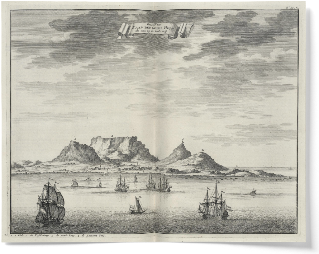
Contemporary offshoring can be seen as part of a longer history of global economic projects in Cape Town. The city has long been the recursive offshore of business frontiers, a location that, in continual iterations, is made to be central because it is peripheral. Ever since five Dutch ships created a refreshment station along the naval route between Europe and Asia, the land that would become Cape Town has been part of an expanded network of outsourcing. Recursively, world-making projects—from the colonialism of the past to today’s AI—have always relied on offshores like these that are made and remade, close and far away.
Naval Waypoints
When Portuguese explorers first circumnavigated Africa in the sixteenth century and established the so-called Cape Route between Europe and the Indian Ocean, they named the continent’s southwesternmost peninsula Cabo das Tormentas (Cape of Storms). Later rebaptized as Cabo da Boa Esperança (Cape of Good Hope), it marked the point where ships from Europe would begin to travel more eastward than southward, eventually reaching the point where the Atlantic and Indian Oceans meet.
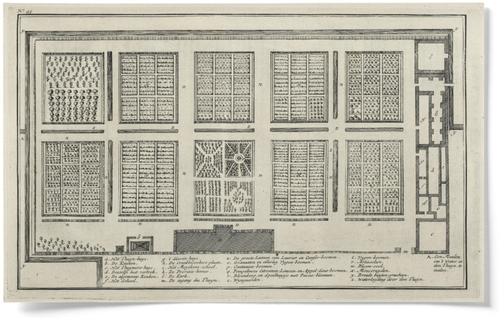
Some fifty kilometers north of the tip of this cape, a bay offered shelter from the frequent storms that had so impressed Portuguese sailors. It was here that, in 1652, the Dutch East India Company (Vereenigde Oost-Indische Compagnie, or VOC) sent five ships and a contingent of company employees to establish a halfway station. The colony they founded, Kapstaad (Cape Town), was a crucial waypoint in the wider technological configuration of shipping vessels. While the Moluccas were farmed for spices, and Java for coffee and sugar, the tip of Africa quickly became the corporate outfit that solved a specific logistical problem: scurvy. Instead of carrying months’ worth of rotting food on long journeys between Europe and Asia, ships would stop at the newly founded colony where the VOC had outsourced its canteen.
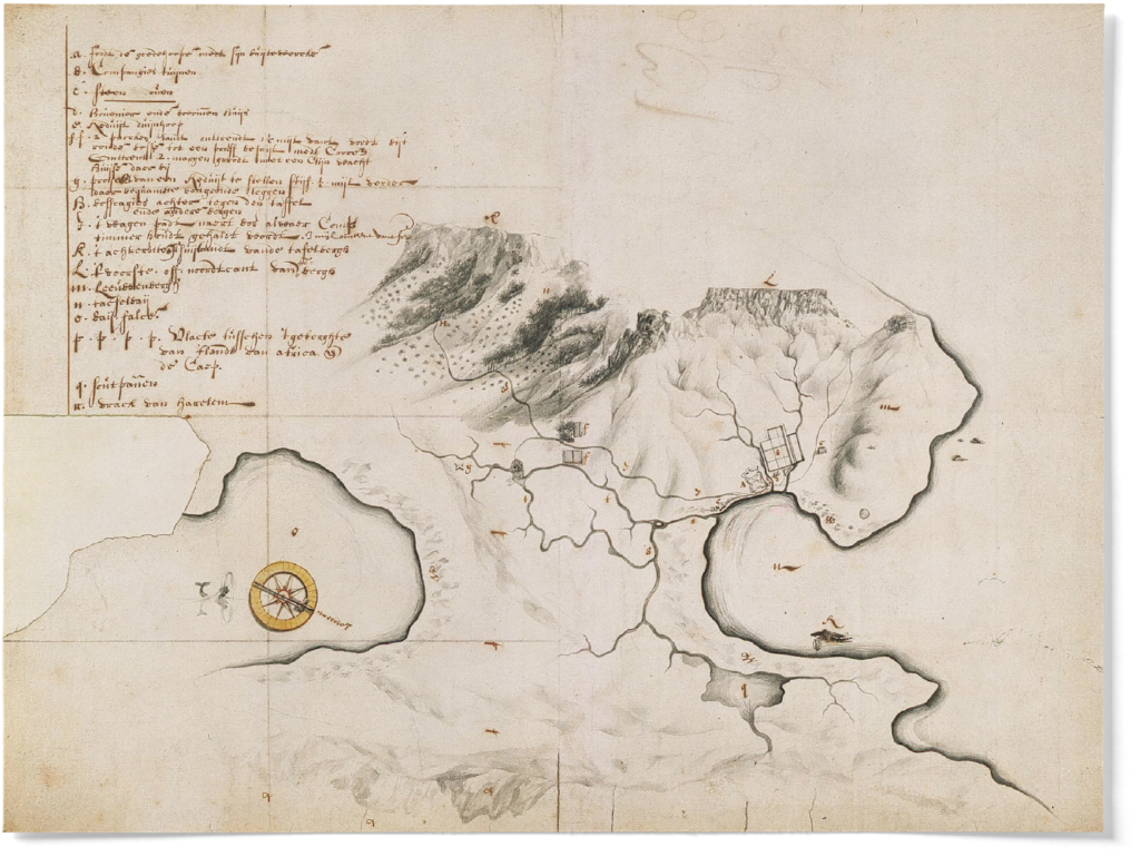
On a large experimental farm known as the Company’s Garden, European seeds were tested and selected for African soil; free settlers were then licensed to cultivate these seeds in the vicinity of the fortified settlement. The architecture of trade at the Cape was designed to preserve the VOC’s control over the provisioning of ships transiting through this mandatory stopover. In the early years of the VOC’s colonial administration, a restrictive system of trading licenses known as pacht was introduced. This system granted certain European settlers exclusive rights to trade on the domestic market and with passing ships, while reinforcing the VOC’s position as the gatekeeper of trade in agricultural goods bought at fixed prices. Revenue generated from the sale of trading licenses benefited the VOC, and the pacht system pushed settlers without the necessary connections to expand the colony’s farming economy further inland.
“In the global AI stack, Cape Town offers geodiversity, just as it did for shipping technologies in the early days of its colonial history.”
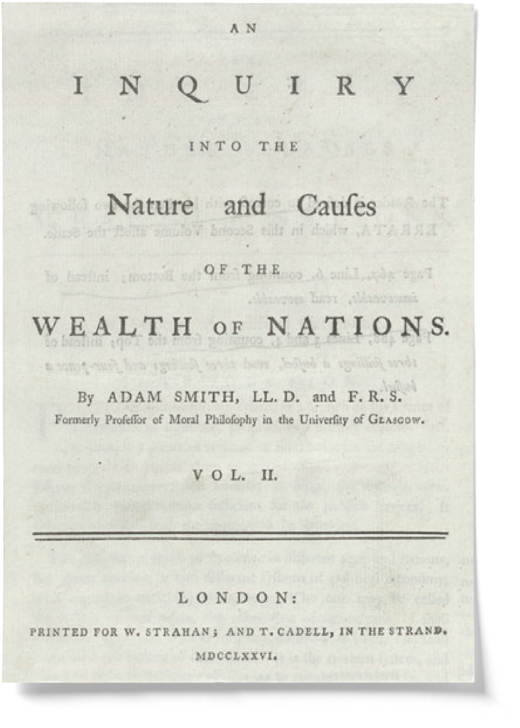
A century later, Adam Smith devoted several pages of his Wealth of Nations to describing the Dutch Cape Colony. As an obligatory stop on the Cape Route, he noted, Cape Town afforded its farmers an inexhaustible market for surplus produce. In other words, Smith explained, due to the availability of cheap, fertile land and labor, as well as its almost Mediterranean climate, agriculture in the Cape Colony perfectly matched European mercantile needs—and the monopolizing practices that Smith intended to critique. What he did not acknowledge, however, was that the offshoring of European agriculture to the Cape had not been cheap, nor had it been easy.1
Terra Nullius
European farming clashed with the herding practices of the original Cape inhabitants, the Khoi and the San. Some of the earliest pass laws, which would later become a hallmark of apartheid segregation, were enacted to control the movement of native people on the farms. 2To avoid further confrontation with these people, the VOC brought slaves to the Cape from other colonies, mostly Java and Madagascar.
And the soil itself had to be transformed. This was especially the case on the sandy plains lying southeast of Cape Town’s harbor, which today are called the Cape Flats. By the time the English took over the colony from the Dutch in the early nineteenth century, all the naturally fertile land had already been settled. To expand agricultural production on “unsettled” land, yet another technological solution had to be imported: no-till farming, a technique that, using the crop residue from previous harvests to form a protective layer, was better suited for the fast-eroding soils of the Cape Flats.
To find farmers skilled in no-till methods, the British colonial administration recruited volunteer, impoverished smallholders from Lünenburger Heide in Northern Germany to come to the Cape. 3 Their farming techniques allowed them to grow vegetables in sandy, poor soils using chicken manure and only superficial plowing. To shield the new orchards, stabilize the dunes, and protect fruits and vegetables from windswept sands, Australian acacias were introduced. These golden-flowered shrubs, whose seeds lie dormant for decades underground, are known locally as Port Jackson willows, and they are to this day among the most invasive aliens endangering Cape flora.

We can read the history of Cape Town as an archaeology of terra nullius. It was the offshoring of agriculture that allowed the imperial claim on the Cape to take root. Here, European farming expanded by displacing and replacing both people and plants, and it thrived by employing free, forced, and chattel labor brought from the most disparate corners of the empire. The offshoring of agriculture was also, as demonstrated by the pass laws, a testing ground for later forms of spatial segregation—a frontier experiment in the violent logistical technology of imperial trade. And while the post-apartheid state has sought to undo these inequities, the legacies of the agricultural Cape Route are still alive: European dining tables enjoy grapes in winter and oranges in summer, grown on the Cape and shipped to Dutch ports all year round.
Retracing the Cape Route
Far enough from Europe and the East Indies to be a central anchor in imperial trade circulations, Cape Town’s strategic position persists throughout technological histories that extend to the present day. In the late nineteenth century, segments of the Cape Route provided the blueprint for the so-called Victorian internet, as telegraphic cables were deployed to facilitate “discipline at a distance” for the British Empire. 4At that time, the Cape Colony became the gateway to yet another imperial project: expanding into the continent to reach the mineral-rich highlands. Most famously, it was the colony’s prime minister, Cecil Rhodes, and his grandiose projects like the unfinished Cape to Cairo Railway and Telegraph that would recast Cape Town as the obligatory stopover between the sea and Africa’s inland frontiers. Eventually, as old technologies gave way to new ones, Rhodes’s telegraphic networks became an invisible patchwork of coaxial telephone lines and high-capacity fiber-optic cables—the lines that now tether Cape Town to the backbone of the global internet, and propel the growth and expansion of the city’s BPO sector.
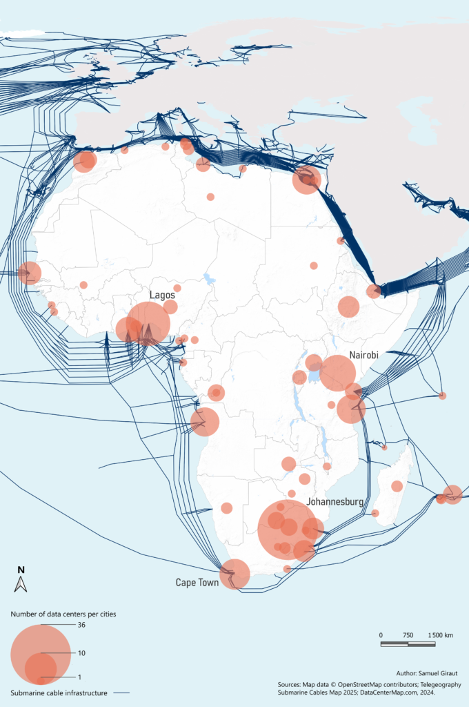
While BPOs might be the present, AI is the future. In the cold, temperature-controlled aisles of Cape Town’s brand-new data centers, both computing power and labor can be outsourced. While servers churn data, on-site technicians known as “remote hands” tend to the machines, swapping a failed drive or recabling a rack for clients whose operations might be thousands of miles away.
In the global AI stack, Cape Town offers geodiversity, just as it did for shipping technologies in the early days of its colonial history. The same geographic advantages that once made the Cape an obligatory passage for naval trade and continental expansion now position it as a digital gateway, offering localized computational power and affordable labor in the AI race.
Notwithstanding issues of energy and water scarcity, the conditions are favorable. Beyond the relatively low cost of labor, the time zone is centrally aligned with many jurisdictions, and Cape Townians speak several imperial languages, including English, Dutch, and German, so both global AI firms and regional markets can be served effectively from Cape Town. In a moment of heightened geopolitical turbulence, the tip of Africa is once again peripheral and yet central to flows of data and labor.
However, as the history of offshore agriculture demonstrates, these transitions are never seamless; they require the transformation of land, labor, and law. Recursivity, after all, is more than just repetition. 5 It involves constantly shifting, contingent logistical geographies of centrality and peripherality. As Cape Town continues to operate at the crossroads of transoceanic networks, new digital frontiers assemble along the familiar routes that have defined the city for centuries. Here, the past lives in the present. The recursive offshore makes Cape Town not just a destination for technology, but a persistent site of fragile, evolving world-making processes. ◆
- Paul Nugent, Race, Taste and the Grape: South African Wine from a Global Perspective (Cambridge University Press, 2024). ↩︎
- Nigel Penn, The Forgotten Frontier: Colonist and Khoisan on the Cape’s Northern Frontier in the 18th Century (Ohio University Press, 2006). ↩︎
- Lizette Rabe, “The Philippi German Agricultural Association: 125 Years of Organised Agriculture on the Cape Flats,” South African Journal of Cultural History 26, no. 1 (2012). ↩︎
- Samuel Giraut, Andrea Pollio, and Liza Rose Cirolia, “Durabilities in the Age of Disruption,” Urban Geography (2025). ↩︎
- Luciana Parisi and Ezekiel Dixon-Román, “Recursive Colonialism and Cosmo-Computation,” Social Text Online (2020). ↩︎